Sunday, 15 January 2017

Monument Valley and Natural Bridges National Parks: 9th October-11th October, 2016

After spending the morning at Antelope Canyon, it was now time to make our way to Monument Valley. The drive was about 3 hours long and when we got there, it was dark. So dark in fact, that we could not for the life of us find the turn off to our accommodation, which meant turning around and driving the half an hour back to town. Once in town we made use of McDonalds Wi-Fi and found directions on how to find our place. We eventually found it.


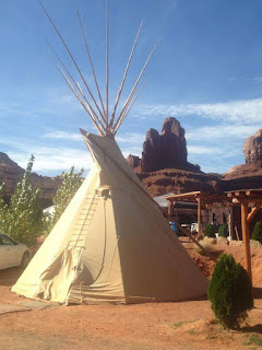
The next morning we awoke and it was my birthday! Just looking outside and around the campsite was breathtaking, with views in all directions of spectacular rock formations. So we were definitely looking forward to the tour we had booked of Monument Valley.


At 11am a local Navajo man picked us up and off we set for a private tour and a fun filled day. First he stopped along the road to explain to us some of the history and stories behind the Indian reservation and the local area. He also told us about some of the formations and the names they had for them, based on their shapes.


There was the bear with the honeypot, the chicken and the horse carriage. He also explained to us about the Merrick and Mitchell buttes which were controversially named after two white men who came in and stole gold and valuables from the Navajo people in the colonial era and went missing when they returned to attempt to do it a second time. Of course when asked the Navajo had no idea what happened to them!
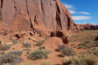


Then it was time to head to the Valley. As soon as we got to the ridge at the visitors centre, there were the iconic views of the three main rock formations, that, if you had seen any Western, Hollywood adventure or West World episode, you would immediately recognise these formations. It really was something to behold. These iconic formations are known as the left and right mittens with Merricks butte off to the side.


After a few pictures we were then told a bit more about the reservation. One interesting thing about it is when the site became a national monument there was a choice offered to the people. If the local Navajo people wished to stay on the land, they were allowed to, except they would have to do so without any electricity or running water.


Some chose to stay, like our guide, however, most chose to leave. The reason as to why they would not have electricity and running water is due to the fact that they wanted to keep the aesthetics natural. The power lines would ruin the view and damage the demand for the site as a movie set. Our guide had found a solution to the problem by making his home 100% powered by solar energy – smart!


It was then time to venture to our next stop. From here we could see the rock formations of The Three Sisters, The Totem Pole and once again the mittens, but this time from a different angle. There was also the option to pay a man on a horse to sit at the edge of the cliff looking like John Wayne from one of his Westerns. We chose not to do this.
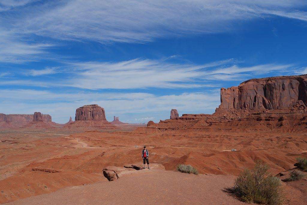


It was then time to continue on even further. From this point you could only go with a guide, so it was a lot less crowded. We were shown many different formations, but there were some which stood out more than others. There was the Native Chiefs head, the horses head as well as a couple of natural arch ways called the suns eye and tear drop arch.


We also saw some hieroglyphs from the times before the Navajo people. Lastly our guide took us to a natural amphitheatre and sang us a song for safe travel and a good life. It was all sung in Native Navajo language and was accompanied by traditional drumming. It was a very cool experience.


Once the tour had finished we made the half hour trip to Mexican Hat for some lunch and a beer. We also purchased some beer (which had to covertly be snuck into our room as the reservation we stayed on is a dry zone), so we could have a few celebratory drinks for my birthday. Speaking of which, it was definitely a birthday to remember!


The following morning we awoke bright and early and made our way to Mexican Hat once again for some breakfast. As we drove out of the reserve we pulled over to the side of the road to capture the classic postcard shot looking back down the straight highway to the buttes in the distance.


After fuelling up, we made the journey over some beautiful and winding hills to Natural Bridges National Park. Now when I say winding, I mean winding. It was also very high and not a good place for anything larger than a 4 wheel drive. However, this did not stop some crazy people and their oversized RVs. Insane!! This was a last minute decision, but one we were both glad to have made.

Natural Bridges National Park is 3 rock bridges situated in traditional Hopi Indian land which have been naturally formed over many thousands of years. To see each one you can either view them from up high at a lookout point, do a loop walk which would take about 3 hours or what we did, which was the 800 metre to 1.5km hikes to each bridge.
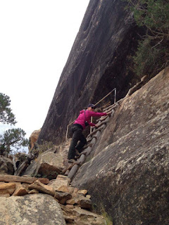
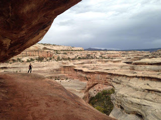


The first bridge, Sipapu, was quite a treacherous walk, with dodgy ladders over steep cliffs and rather precarious looking steps. However, the view when we got there was totally worth it. It was this big canyon with a massive natural rock bridge across it. It was definitely impressive.


Also incredible was the fact that this bridge was naturally formed by running water. Now when you saw the height of the bridge from the bottom of the canyon floor, it was almost impossible to imagine. It would have to be at least a 40ft gap!


The next bridge, Kachina, was just also cool and was visible after only a little hike. While it was impressive, the best was yet to come. The third bridge, Owachomo, was the thinnest looking one, but the longest and most impressive. It was a very short hike to get to it and once standing underneath it, you couldn’t help but think it was going to snap at any moment. Also, you could see some very small fault lines in it, which added to the worry of it’s almost inevitable collapse. Although according to the geologists, it won't be for a very, very long time!


After soaking in the enormity of the bridges, we eventually got back to the car. I was thankful to have reached the car as I had begun to come down with Adrian’s cold. He’s such a good sharer! Then it was time to make our way to Cortez and Mesa Verde.


Holly.

Monday, 9 January 2017

The Grand Canyon and Antelope Canyon: October 6th - October 9th, 2016

The drive east out of Las Vegas took us through more expanses of arid and rocky mountain ranges. There were several viewpoints along the freeway and we learned that this area (the Black Mountains) is actually the home to the largest bighorn sheep population in America. We kept our eyes peeled but sadly were unable to spot any of the elusive beasts.


We were heading towards a large town called Flagstaff located towards the centre of the state of Arizona. Flagstaff was an appealing option for our base for the next few days due to its proximity to the Grand Canyon national park. It also had several accommodation options that were not going to break the budget!

The closer we got to Flagstaff the more we noticed the terrain around us changing. We were gaining plenty of altitude and were starting to encounter large forests of pine trees. The bighorn sheep signs faded away, only to be replaced with warnings about the much larger and more spectacular elk. By the time we reached flagstaff we had reached 2100 metres above sea level and some of the coolest temperatures we had experienced on the trip so far (our first night the temperature hit 4 degrees).
We had planned for two full days at the Grand Canyon and we decided that we would spend both at the south rim as it seemed that it had more to offer. The fact that is was around 2.5 hours closer to Flagstaff than the northern rim, also made it a lot more appealing!


We made the 90 minute journey across on our first morning, bought our entry passes and approached the main visitor centre area. The visitor centre had 3 primary car parks and all were completely packed full! We circled around for a few minutes resorting to stalking people returning to their cars (like at the supermarket) and eventually managed to get ourselves a space.


We were a bit worried that with the sheer amount of people who were obviously there for the day that the trails along the rim would be teeming with people but, luckily for us it seemed that few really seemed to venture far beyond the couple of lookouts within a couple of minutes of the centre. This worked for us as it meant for long stretches of the eastern bound trail, it felt like we had the canyon to ourselves.

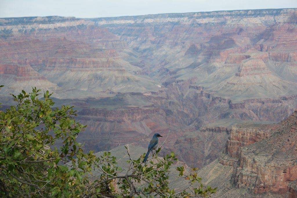
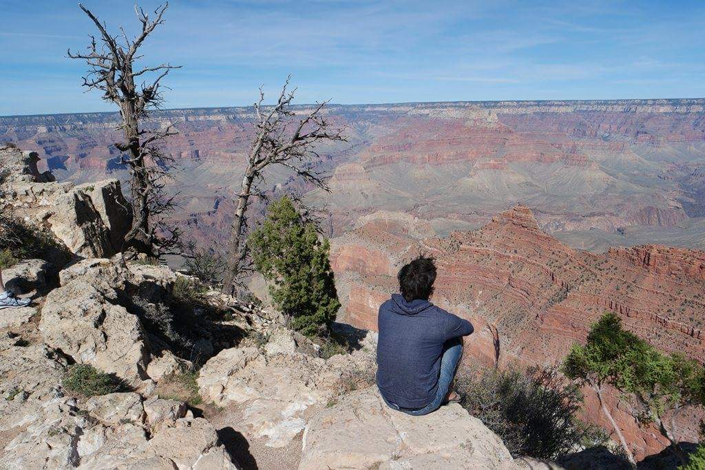
The canyon itself was a phenomenal sight and was so vast and spectacular, that it felt like we had stumbled onto a movie set. The eye could just not seem to actually comprehend what we were looking at, with the canyon floor so deep below us and the expanse stretching away in each direction as far as the eye could see. Even in the pictures we took, it seemed to me like we were standing in front of a background painting instead of the real thing!


We walked along the rim for a few kilometres, stopping every now and then for some pictures and to marvel at the amazing sights. We also kept an eye out for any wildlife that might be in the area. We had read that bighorn sheep, elk, mule deer and mountain lions all frequented the southern rim, but sadly the best we saw were a few scattered droppings across the trail.


We turned around and walked back to the visitor centre, braving the throngs of tourists to check out the popular Mather Point lookout. The views were amazing. The lookout was located on a rock spur that jutted out in to the canyon resulting in great visibility, but we did miss the exclusivity of the trail we had been walking along earlier!


We decided to take the Eastern exit out of the park which meant driving along a 23 mile road through the dense Kaibab National Forest. No sooner had we finished telling each other to keep a good eye out amongst the surrounding trees for any wildlife, then a massive herd of elk to decided to cross the road just a few metres ahead! The animals seemed completely nonplussed about the car traffic and dawdled across taking their time. Due to the tightness of the forest around the road and the moving cars, we were unable to pull over for some photos. However, the viewing was very exciting and we continued to scan the forest as we drove east. Sadly no more elk presented themselves but we did see a buck mule deer grazing in the grass by himself.


We stopped at Desert View, the final lookout along the rim of the canyon before exiting the park. In 1932 a watchtower had been built here for the purpose of marking the boundary of the national park. This added a dramatic feel to the views of the canyon and as the sun was just starting to set the colours were absolutely phenomenal. We admired the sights for an hour before getting back in the car and returning to our hotel in Flagstaff.


Day 2 started a little earlier than day one. We were determined to make the most of a day exploring along the western edge of the south rim. We traversed along a couple of miles of the rim with some fantastic viewpoints until we saw, far away in the distance, a trail winding down to the canyon floor.


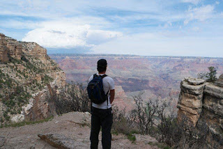
We decided to take the opportunity to see the canyon from a different perspective and went back to pick up the car and drive along to the trailhead. The trail was called 'Bright Angel trek' and was a 20 mile (32km) round trip journey with a recommended trip time of 8 hours. As it was already well past midday we decided to just hike down to the 1.5 mile point in order to get a good feel for the trail.


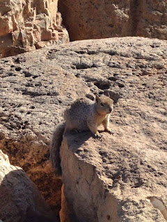
As we started down we were a little intimidated by the multiple warning signs detailing the dangers of the trail (steep incline, hot conditions etc) and the stats listing that on average, 25 foolish tourists have to be airlifted off the trail each year as they have bitten off more than they can chew. The trip down was very quick and scenic. Plenty of hikers making their way back up the trail told us we wouldn't be enjoying ourselves so much when we turned around. By the time we reached the small hut at 1.5 miles, we had already descended 1,131 feet (around 350 metres) down in to the canyon. We stopped for a quick lunch, with a few local squirrels emerging from the surrounding scrub and attempting to share, before turning around and making the climb back up towards the rim.


The going was tough but we made it back to the trailhead without any issues. Along the way we did see a couple of examples of people who had over exerted themselves, and it was easy to see how this could have happened. The sights and experience of doing just this small 3 mile portion of the trail were fantastic and we were determined that if we ever return to the canyon we get an early start and attempt the whole thing!


We headed back for our final night in Flagstaff and once again chose to take the scenic Eastern drive out of the park. We were hoping to see some more wildlife along the road again and we were not disappointed. About a third of the way towards Desert View we encountered our elk herd again, this time grazing peacefully just off the road. We had plenty of time to pull over and grab a few quick photos before getting back on the road.


The next day was to be a transit day between Flagstaff and Monument Valley, but we decided to throw in a last minute detour to a place located up on the Arizona/Utah border, Antelope Canyon. This would mean an additional 4 hours added to our driving time for the day but if it was going to be anything like the pictures we had seen it would certainly be worth it!

Antelope Canyon is divided into 2 separate sections, the upper and lower. Guided tours are required and provided by the local Navajo tribe as the site is part of an Indian reservation. As we booked our tour last minute we only had the lower canyon available to visit and we arrived in the early afternoon ready to set out.

We were divided in to groups of around 15 people and each group was assigned a native guide to walk down to the canyon entrance. After a brief introduction we were advised 'be prepared for the slowest quarter mile of your life' and when we reached the stairs leading to the canyon floor it was easy to see why! The entire canyon was packed with people slowly shuffling along and stopping regularly for photos.


From above, the canyon was barely visible beyond a couple of tiny openings, but from the floor the sights were spectacular, with the rocks having been carved in to waves and patterns caused by an old river that had once flowed through the region. Everything was so dry that it was a surprise to learn that floods had affected the area as recently as 2012 when the canyon had been filled to the point of overflowing by excess water running down from the distant mountains. We also learned that the area had got its name from the times long ago when pronghorn antelopes once frequented the area.


The trip through the canyon was as slow as promised, but the many different and striking sights round each bend gave us a lot to look at. There were several formations that had been named as they bore a resemblance to various figures with importance in Native Indian culture. For example the bison and the chief (some were easier to see the resemblance than others), while others such as 'the shark' seemed to have little relevance.


The canyon varied in width with small rooms where people could gather, to spots only wide enough for one person to squeeze through at a time. There were bands of rich reds and yellows running through the rock as well which added some great ambience to the sweeping canyon walls. We were also shown a great insiders tip of leaning our cameras right up to the wall, taking the photo and then maximising the saturation of the shot which filled out the spectrum of colours to include purples and even blues.


After approximately an hour we reached the exit ladder and climbed back up to ground level. Fully satisfied with our little scenic detour we jumped back in to the car and headed east towards out next geological wonder, Monument Valley.


Adrian.

Havana, Cuba: 11th December to 15th December, 2016.

After leaving Isla Mujeres, we spent a night back in Cancun, before the next day catching a flight to Cuba. Only a day before we arrived in...