We knocked over the first 4 hours fairly quickly and comfortably and it was very pleasant driving through the green birch and pine Canadian forests. The whole way we continued to scour the sides of the roads for wildlife (particularly moose) as we had been doing the whole trip to date without much success. However, a moose sighting remained high on our bucket list and we were going to make it happen!
We also started to keep a lookout for potential places for a lunch stop and spotted a sign for the intriguingly named ‘Mastodon Ridge’. After some searching and backtracking we found our desired location and found a life sized mastodon sculpture at the top of the small hill as promised. This place was marking the exact halfway point between the Equator and the North Pole as each place was exactly 4985km away from this small town of Stewiacke. What better place to have the ultimate symbol of Canada – a Tim Hortons! We visited the mastodon statue and found that mastodon remains had been found in a nearby tar pit and that this monument had been erected as a tribute.
We got back in to our car and continued North. It wasn’t long before we crossed the border in to New Brunswick and arrived at a small town called Aulac. Here we stopped and weighed up a travel decision. We had seen many great photos of a site called Hopewell rocks on the northern, New Brunswick side of The Bay of Fundy. These rocks are famous for being the point of the highest tides in the world, allowing visitors the chance to walk the ocean floors. To visit these rocks would add an extra 3 hours on to our drive time but we decided to make the trip and enjoy the promised great experience.
 |
| High tide at Hopewell Rocks |
We arrived at the Hopewell Rocks site at approximately 3.30pm where we found that we had arrived at high tide on a cloudy and blustery day. After paying our admission and making the short hike down to the famous ‘flowerpot rocks’ I have to say we were a little underwhelmed. The rocks were essentially… rocks, that were partially covered by the waters of the bay. We took a few photos and decided that we needed to see these rocks at low tide in all their promised glory. The low tides were arriving around midmorning for the next few days and we decided after two nights in PEI we would detour over again and make the most of the experience.
Continuing on with our drive, we reached the huge Confederation Bridge, the only land crossing to the island. This bridge is immense and is 13km from shoreline to shoreline. We drove across and arrived to our location in the province capitol of Charlottetown. We stayed at the HI hostel in the ‘loft’ apartment which turned out to be the best room in the whole hostel!
The next day we decided to spend the morning wandering the streets of the city. Charlottetown is a pretty harbourside city of 35,000 and named after the Queen Consort of England in the late 1700s. Also, Charlottetown is most famous for being the location of the conference between mainland Canadian delegates and members from each of the three maritime British colonies (Prince Edward Island, New Brunswick and Nova Scotia) in 1864. It was this meeting that laid the groundwork for these powers to join together and 3 years later become the country of Canada as we know it today.
 |
| Commemorating the conference of the Confederation |
At the harbour we stopped for a Cows ice cream in the store near the moored boats. Cows ice cream is a brand famous through the Maritimes, but it originated from PEI. The flavours of both the ice creams we had, as well as the chocolate waffle cones were delicious, but to me it seemed that the brand had spun out of control. The ice cream store was filled to the brim with Cows merchandise (shirts, hats, pajamas etc) and the tourists were going to town!
After lunch we decided to drive out around the greater area of the island to experience some more varied sights. The majority of PEI is fertile farmland with flat green farms covering most of the space. Famously, because of this the novels (and movies) the Anne Shirley series (most notably Anne of Green Gables) were set on this island amidst the beautiful English style farmhouses and gardens.
 |
| The Basilica of Charlottetown |
The southern shore of the island showcased several red cliffs where the land met the ocean. PEI, along with Australia is one of the few places on Earth to feature the bright red rocks and soil which contrast nicely with the blues of the ocean. A pretty sight to see.
We finished our day back in Charlottetown by sampling some of the local beers and soaking up the atmosphere in the local Irish pub with a Toronto Blue Jays baseball game on TV. We also met some lovely English people, who now call Australia home. They sure kept us entertained. In all Charlottetown was an interesting ‘city’ to explore.
 |
| Sunset views from Victoria Park, Charlottetown |
The next morning we again got up early and set out for our return visit to the Hopewell Rocks. Again this would add an extra few hours to our travel for the day. However, we were hoping that The low tide experience would justify the rave reviews we had heard.
Before we could head to the rocks we had to leave the island. We again headed for the confederation bridge, but found that to leave PEI a toll is required. We drove up expecting to pay the regular 4-7 dollar toll, but were shocked when we found the charge was $46 for a standard car! I guess it takes a few dollars to construct a 13km bridge!
Once we had completed the crossing we once again travelled through New Brunswick and arrived at the Hopewell Rocks for the second time and right at the scheduled 11am low tide. As we arrived we immediately found a huge difference to our first visit, starting with the hoards and hoards of fellow tourists! On our first visit we had been surprised at the vast size of the carpark and how empty it was -our second we had to park in the carpark overflow!
The rocks were an entirely different sight at low tide. I mentioned earlier that this was the exact location of the highest tide in the world and to be more specific, I mean a difference of over 14 metres from high to low tide. This meant that not only were the flowerpot rocks now fully exposed but also that a huge area of the ocean floor was now open for exploring.
The flowerpot rocks themselves were amazing, each now towering above us as we stood and watched from the newly exposed land. The base of each had been eroded away by millions of years of contact with the ocean currents creating the effect that each rock was top heavy and could potentially topple under its own weight. There was even an arch that could be walked through right under the rocks that is completely submerged at high tide.
After spending an hour or so climbing over rocks and mounds of seaweed it was time to get back on the road and head to Cape Breton Island, the final stop on our loop of the Maritimes. This was another lengthy drive which meant that we would not arrive at our accommodation until after 7.30pm. Right at the time dusk was starting to set in.
Thanks to some issues with our Tom Tom, we overshot our intended destination and were led along the Cabot Trail for another 20km or so. As frustrating as this was it led to the moment we had been waiting for. The first moose sighting of our trip!
We had just wound our way up a steep hill and rounded a bend to a flat section of the road with a marshy clearing on our right hand side. Perfect moose territory. Then sure enough, we both saw out the corner of our eyes a huge cow moose standing in the swamp. We pulled over quickly and excitedly jumped out of the car, but the creature had been spooked and run away.
This was an exciting development though and bode well for the next 2 days that we were spending in the Cape Breton Highlands National Park. We turned around and made our way back to our lodging – a fantastic luxury cabin on the beach next to the Dancing Moose Café. The café was run by a Dutch man named Ton who provided us with excellent breakfasts (pannekoeks) and lunches for the next 2 days of exploring.
The next morning we got up and had an early start as we drove from the eastern side of cape Breton around to the skyline trail on the western shoreline. The drive across was fantastic as we followed the beautiful Cabot Trail which wound it’s way around the park perimeter.
The Skyline Trail is the most popular hike in the park. A 10km round trip along the summit of French Mountain (455 metres). It is famous for amazing views out over the ocean as well as being the location of a bizarre coyote attack that resulted in a human fatality in 2009. As a result warning signs were up everywhere at the trailhead detailing how to handle a pack of coyotes.
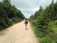
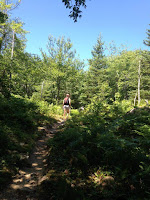
We started down the path and were no more than 5 minutes in before a lady on the path ahead of us started pointing in to the trees off to the side of the path. We hurried up and saw that she had spotted a huge bull moose grazing about 20 metres away! We stayed and watched as he slowly made his way through a grove of trees and off in to the distance.
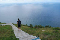
After this exciting start we continued our way around the trail. This led us to the boardwalk out over the mountain ridge and the panoramic views it offered over the ocean. There were also views over a section of the windy Cabot Trail as it snaked its way between two mountains. What a great place to stop for lunch!
As we made our way back through the second half of the trail we saw several sections of the park fenced off. We found out that this has been done in order to rehabilitate the park due to overgrazing by the local moose population. A lot different to when the moose in Cape Breton had been hunted to extinction in the 1800s.
However, the national parks reintroduced 18 animals in to the park in the 1930s. Due to a beech tree growth explosion in the last couple of decades there are now 4 to 5 thousand moose back in the park!


We completed the skyline trail with no further sightings. Also there was also nothing on the 2 smaller trails we hiked on the way back to our cabin. The next morning we decided to tackle the toughest trail in the park – Franey Mountain. The trail was not as tough as advertised and after about an hour of climbing we reached the summit and an amazing view out over the town of Ingonish and surrounding coastline.
After Franey we continued on the Cabot trail and stopped at several of the lookout points over the rugged and rocky coastline. At one of these stops we watched out over the gannets as they fished out in the open ocean. The gannet is a seabird a little larger than a seagull with a unique fishing technique. Each gannet would circle up on the air currents until they spotted some morsel of food down in the ocean. Then, suddenly, the gannet would plunge from the heights right down through the surface of the water with a splash, audible even from where we stood on the shore.
Following on from these lookouts we grabbed a late lunch and undertook the drive back to the Dancing Moose. Luckily for us our wildlife viewing was not yet at an end, as we rounded the bend right where we had sighted our first moose, we saw a lady with her car pulled to the side of the road madly snapping pictures. We peered over and saw a large cow moose and her calf feeding amongst the swampy waters. Sadly for the second time these moose did not hang around long enough for us to take photos but we were certainly feeling pretty lucky!
The next morning we woke early, had our final pannekoek, and set out on the long journey back to Halifax. All in all we bad driven nearly 3000km around the Maritimes and it was time for us to move on to the next destination – Toronto.
Adrian.


Excellent
ReplyDeleteNext best thing to being there, Dad loved the pics of the tides xxxx
ReplyDeleteOh excellent. Yeah pretty incredible the difference! Water is for sure not as blue as all the Google pics suggest. Lol
DeleteYeah those tides are amazing! Can definitely tell Adrian wrote this one. So excited by the animals. Keep having a great time. Xx
ReplyDeleteThis comment has been removed by the author.
ReplyDelete